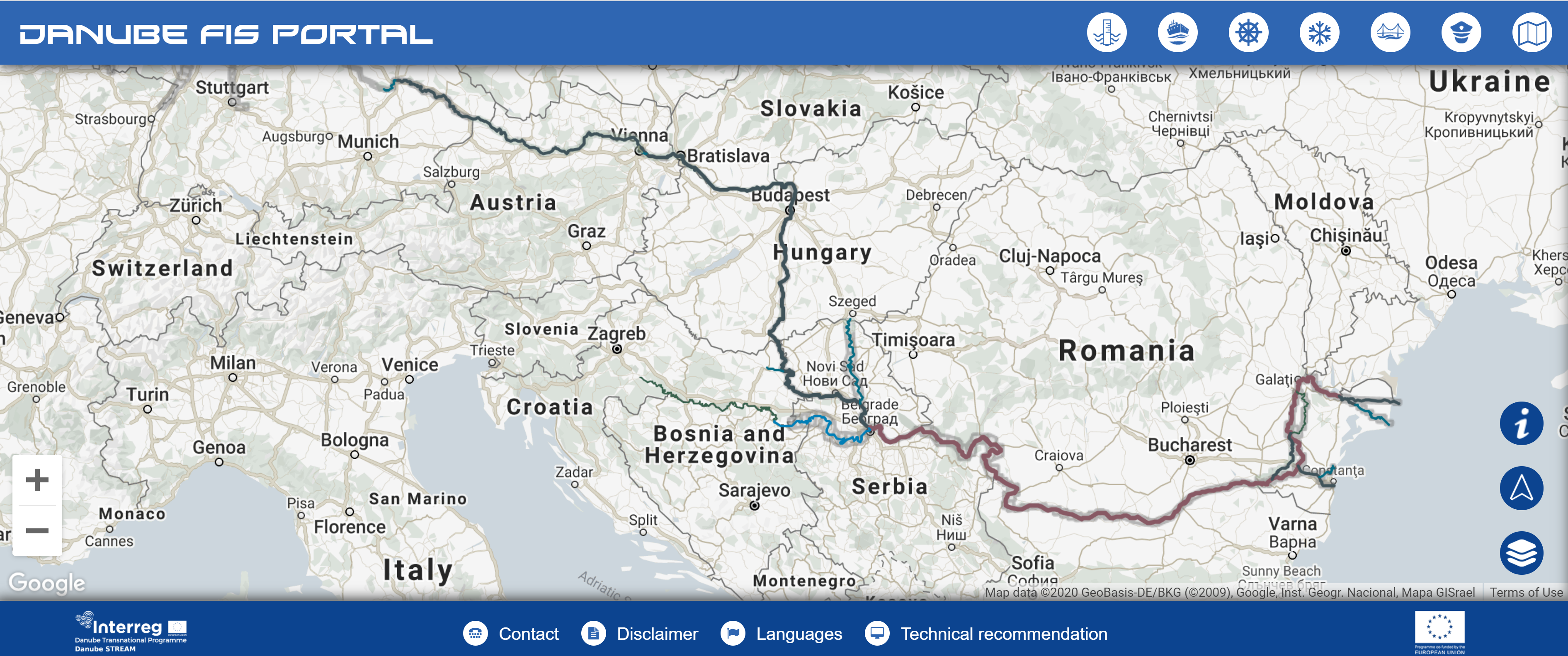
The Danube River, which flows for 2 857 kilometres, is one of the key corridors for transporting people and goods, and connecting Western and Eastern Europe.
However, the waterway is under-exploited as it is estimated that only 10 % of its transport capacity is being used. The NEWADA, IRIS Europe II and FAIRway projects have the shared goal of improving the transport capacity of the Danube and its tributaries.
Navigation on the Danube, which has a number of economic, environmental, social and developmental benefits, can only be improved by international cooperation, joint planning and coordinated activities. The IRIS Europe I project, initiated in 2006, challenged national variations in the collection and dissemination of information about waterways, which are hindering inland navigation in Europe. In 2009, the IRIS II project set out to improve and develop the application of river information services (RIS) on European waterways by providing comprehensive details about the waterways at the international level. Thanks to IRIS I and II, comprehensive cross-border information is now available about the river’s water levels and nautical depths, which is crucial for navigation.
The NEWADA project, completed in March 2012, prompted the synchronised development of the waterway and the setting of common qualitative standards. It brought together 12 institutions from Austria, Bulgaria, Croatia, Hungary, Serbia, Romania and Ukraine for waterway maintenance and river navigation.
Better cooperation in hydrography and hydrology helped to save resources and improve quality and compliance with environmental standards. The application of information and communication technologies on the Danube was also improved thanks to the development of various RIS components, such as the harmonisation and enhancement of electronic navigational charts.
One-stop info point
Under the NEWADA duo project, a Danube Region information portal ( www.danubeportal.com ) was created to provide data on water levels and critical bottlenecks, as well as notices to skippers, ice warnings, WiFi hotspot information, etc.
Based on these projects’ results, in 2014, transport ministers from the Danube countries adopted the Rehabilitation and Maintenance Master Plan for the Danube and its navigable tributaries. The FAIRway project, involving the waterway administrations of six EU Member States (Austria, Bulgaria, Croatia, Hungary, Slovakia and Romania), aims to implement this plan and to buy modern equipment for hydrological services. The goal is to provide up-to-date, reliable and harmonised information on critical spots on the waterway, water levels and water-level prognoses along the entire length of the Danube. Such databanks are important not only for planning waterway transportation, but also for maintenance, hydro-construction measures or adjustments to the current water flow.
FIND OUT MORE:
IRIS Europe 2: http://www.afdj.ro/en/content/iris-europe-ii
FAIRway: http://www.danube-navigation.eu/item/809814


